VTS 3.7 “Night” released

The VTS team is very pleased to announce that VTS 3.7 “Night” has been released and is available for download at https://timeloop.fr/vts/download.

VTS 3.7.0 Night doodle


What’s new ?

This version is mainly focused on bug fixes and improvements, here are some notables changes.

Dark mode

A dark theme has been added for a more comfortable user experience. It can be enabled through the File/Settings menu.

ZenithView targeting tool

ZenithView display has been improved, enabling users to show a pointed direction by holding down the shift or ctrl key.


ZenithView coordinate tool


Scriptable Infobox experiment

A basic JavaScript interface has been added for Infobox, providing more control on display. This feature has a very small API for the moment but will be improved in the future.

Infobox js script

Colormap for Timeline event data files

Customization of timeline colors is now possible by utilizing colors defined in CIC-CCSDS color files. This feature can be accessed through the “configure timeline options” dialog.


Accessing Help in the VTS Configurator

As a reminder, all features are described in the user manual available as contextual help within the VTS Configurator by pressing the F1 key.


[image credit]


VTS 3.6.1 “Rendezvous” released

The VTS team is very pleased to announce that VTS 3.6 “Rendezvous” has just been released and is available for download at https://timeloop.fr/vts/download.


What’s new ?

Relative coordinates

It is now possible to specify a reference frame to define the position and attitude of a satellite. By default, the reference frame center is the satellite parent body, but it can be changed to another satellite. The available reference frame types are : EME2000, Body fixed, TNW and QSW. Position and attitude are defined in the same reference frame.

A chaser satellite defined with absolute coordinates (blue), and the same satellite defined with relative coordinates (pink)

Reference frame definition in the Position/Orientation panel


Visualizers

New graphical objects can be added to a satellite (only, for the moment) to visualize the orbits in a more visual context. Currently the available visualizers are ellipsoids, grids and spherical shell.

A grid visualizer displaying XY, YZ and ZX planes of a reference frame
A sphericall shell, defined with a minimum and maximum latitude, longitude, altitude
A sphericall shell, defined with a null longitude and attached to a bodyfixed satellite at the center of the Earth

Much more !

  • Support for CIC data exchange protocol version V3.0
  • New “Tracking Shot” mode to define custom camera travelling animations
  • Cascade layout in the Window Geometry Manager

To see the complete list of features, improvements and bugfixes included in VTS 3.6 please read the full changelog.

Contact us !

As always we are interested in your feedback to keep improving VTS.

Take a look at our contact page to send us any comment, suggestion or question you might have.


VTS 3.4.2 released

We are happy to announce the release of VTS 3.4.2 !

This release fixes a regression with ground station “Sensors Surface” property not working properly in OmniView applications, and with ground station visibility links invalid display in ZenithView.

VTS 3.4 “Moon” released

We are very pleased to announce that VTS 3.4 “Moon” has just been released and is available for download at https://timeloop.fr/vts/download.

What’s new ?

Lunar missions

Exciting missions are coming for solar system moons (MMX, JUICE, …). VTS 3.4 adds support for missions to solar system moons and small bodies by allowing you to define mission ephemerides in the celestial body reference frame.

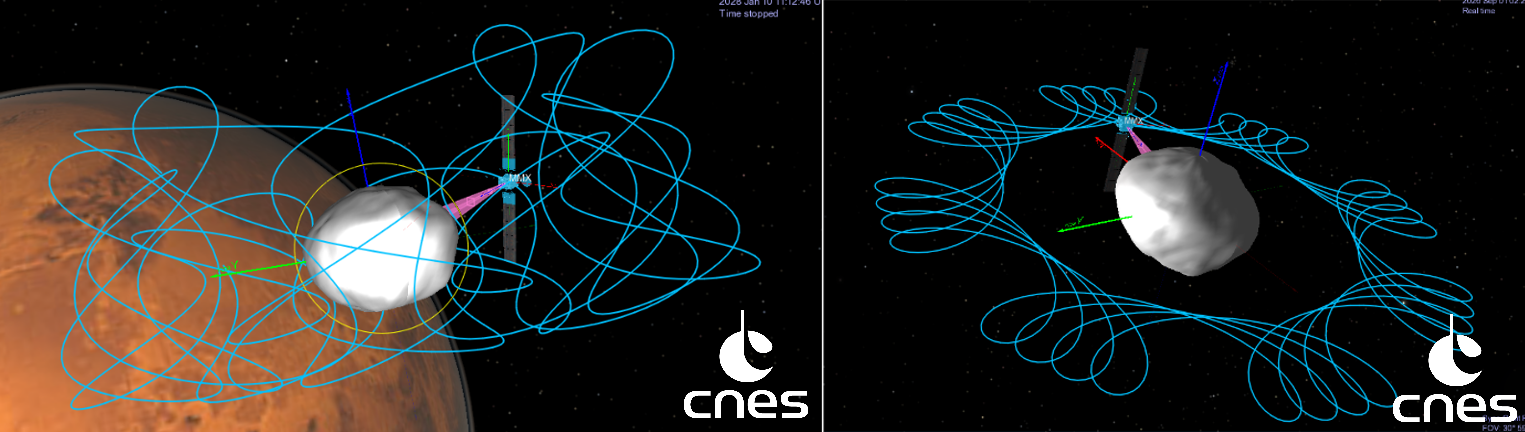
MMX position in Inertial Frame centered on Phobos during 10 terrestrial days.
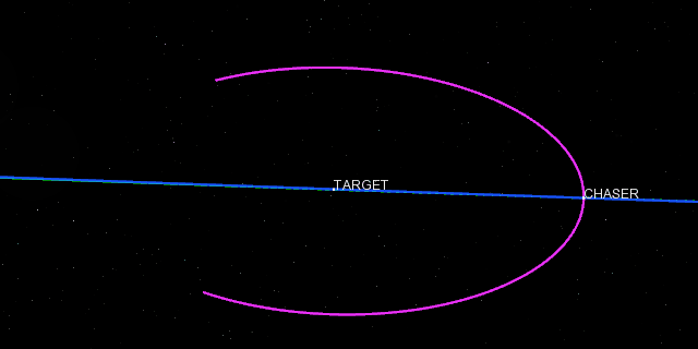
On the left, 3D low altitude QSO, on the right, 2D low altitude QSO. [1] [2]
Martian Moon Exploration (MMX)

VTS 3.4 also includes CNES ephemerides for the Moon which can now be selected from the list of celestial bodies.

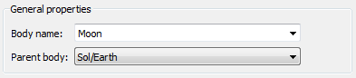
The Moon can be selected from the drop-down list. Note that both Moon and Earth must be added to the list of Celestial bodies.
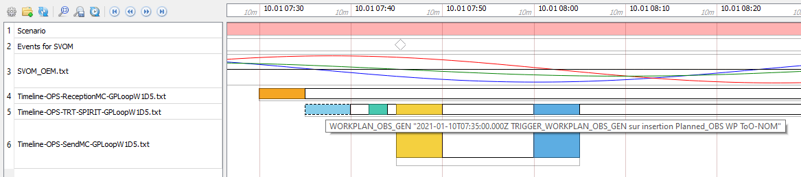
Timeline badges

Dealing with multiple items in VTS Timeline can become a difficult task, specially when no file naming convention is defined! VTS 3.4 allows you to organize Timeline files with the help of badges.

Badges can be added to any Timeline file and can represent anything relevant to the mission (such as a category or a specific format). The contextual menu allows you to add/remove badges, rename or customize existing badges and also to use them as filters for the displayed files.

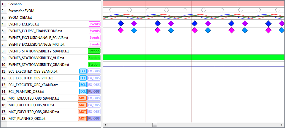
The way Badges are displayed can also be customized from VTS settings.

Display modes : No text, Always text, Text on hover

Station-Satellite visibility links

In 2017, VTS 3.1 added the possibility to display Station-Satellite visibility links in SurfaceView.

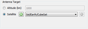
Station-Satellite links are displayed for satellites defined in the Station targets

In VTS 3.4 we continue to improve this feature by adding support in Celestia and ZenithView.

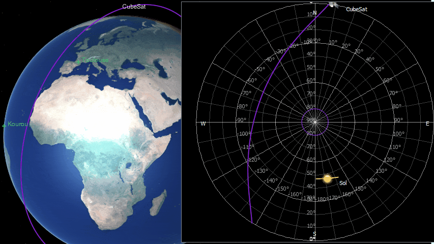
Customization is also improved as now you can change the font and the text that is displayed from the application initial states (i.e. VTS>Applications>ZenithView).

Much more !

  • Ground station sensors can be defined with Azimuth-Elevation constraints
  • Mode “Synchronize with system time” can be dynamically disabled and re-enabled from Broker
  • PrestoPlot client upgraded to version v19.11

To see the complete list of features, improvements and bugfixes included in VTS 3.4 please read the full changelog.

Contact us !

As always we are interested in your feedback to keep improving VTS.

Take a look at our contact page to send us any comment, suggestion or question you might have.


[1] “Design of realistic trajectories for the exploration of Phobos”, Canalias et al., AIAA Space Flight Mechanics Meeting, Kissimmee (FL, USA), January 2018, https://arc.aiaa.org/doi/abs/10.2514/6.2018-0716

[2] “Mission Programming for the Mars Moon eXplorer Mission”, Astruc Maxime, 2019.